
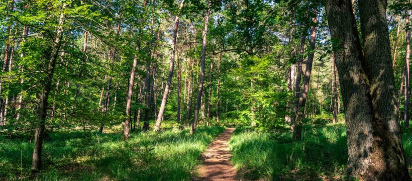
This guide brings together 15 routes I have run in the Fontainebleau forest, south of Paris: the Denecourt-Collinet trails, marked with a blue stripe (sometimes with their number), and a station-to-station crossing on the GR long-distance paths. Each route has its own sheet, with a map, an elevation profile, photos, a description and its GPX track.
The difficulty comes mostly from the distances. Every route has a small dose of rocks to skirt (no climbing), roots and sometimes sand: ideal for trail running training in the Paris region. The forest floor is often loose and suffers a lot from erosion, which is why I like to change ground often, and I only mountain bike on the wide tracks. Check yourself for ticks after your outing: they are common in the forest.
Before you go: the state of the forest after the fire
The fire of 12 July 2026, which started near the A6 motorway at Noisy-sur-École, affected about 2,000 hectares, nearly 10% of the forest. The Trois Pignons area, home of the 25 Bosses, remains closed. About 80% of the forest has been accessible again since 22 August.
Closed areas and some car parks change over time. Check the ONF (French forestry office) map before each outing. The statuses in this guide are calculated by crossing each track with the closed areas published by the ONF. They do not replace the official map or the signs on site. For background and restoration work, see my article on the 25 Bosses (in French).
Zones interdites : dernière extraction de la carte ONF le 18 octobre 2026. Vérification automatique tous les mois, la carte ONF reste la référence.
Map of the routes
Turn each layer on or off: routes, car parks, stations and closed areas. Click a route, on the map or in the list of buttons, to see its summary sheet and download its track.
- Zone interdite (ONF)
- Parking ouvert (ONF)
- Parking fermé ou partiel (ONF)
- Autre parking (OpenStreetMap)
- Gare
Zones interdites : dernière extraction de la carte ONF le 18 octobre 2026. Vérification automatique tous les mois, la carte ONF reste la référence.
Fonds de carte : Plan IGN et © contributeurs OpenStreetMap. Zones interdites et parkings ONF : carte ONF (uMap). Autres parkings et gares : OpenStreetMap.
All routes


Denecourt 6
Les gorges d’Apremont
10,2 km · D+ 115 m
Partiellement fermé (30 % du tracé en zone interdite)

Denecourt 7
Les gorges de Franchard
13,3 km · D+ 83 m
Partiellement fermé (11 % du tracé en zone interdite)


Bois-le-Roi à Bourron-Marlotte
De gare en gare par les GR
32,8 km · D+ 343 m
Partiellement fermé (9 % du tracé en zone interdite)
Denecourt 1 and 3: from Mont Ussy to Rocher Cassepot
- Distance
- 10,7 km
- Dénivelé positif
- 147 m
- Dénivelé négatif
- 144 m
- Altitude
- 95 à 152 m
- Type
- Boucle
Accessible
Gare la plus proche : Fontainebleau-Avon, à 2,3 km à vol d'oiseau du départ.


Getting there
I combined these two trails to reach about 10 km. Several starts are possible: the Maison Forestière des 8 Routes in Fontainebleau, start of Denecourt 1, reachable on foot from Fontainebleau-Avon station (2.4 km), or the Croix d’Augas, start of Denecourt 3, which lets you run a figure of eight.
The route
From the forest lodge, the trail starts gently on a singletrack before reaching Mont Ussy. It climbs a little, then leaves it to reach the ramparts, in an out-and-back section that joins Denecourt 3 and lets you open up your stride.
You then reach the Croix d’Augas, where you cross the D606 (on a bridge, don’t worry). It starts among Corsican pines: 1.5 km of flat before reaching Rocher Cassepot. You climb to a first viewpoint and pass ponds, an old quarry, a view over the north of the forest and a procession of rocks and ferns. Fontainebleau in a nutshell.
You return to the calm of the pines to pick up Denecourt 1, this time turning right towards the rocks of Mont Ussy. For Denecourt, the Mont-Ussy walk was “the most beautiful among the most beautiful”. Judge for yourself, but running it is great fun. You finish through the Montussiennes caves, which signal the end, then the Vallée de la Chambre and the forest lodge.
Variations
- You can add Denecourt 2 for a hat-trick, from the Vallée de la Solle road near Rocher Cassepot, or from the Croix d’Augas.
- Denecourt 14 gives a slightly longer link to Denecourt 2 or Denecourt 15.
Denecourt 2: the Fountains
- Distance
- 7,1 km
- Dénivelé positif
- 108 m
- Dénivelé négatif
- 105 m
- Altitude
- 105 à 156 m
- Type
- Boucle
Accessible
Gare la plus proche : Fontainebleau-Avon, à 0,4 km à vol d'oiseau du départ.


Getting there
This is the route closest to Fontainebleau-Avon station: one of the starts is literally in front of it. Just head up Route Amélie, a good climb. I started from the Croix d’Augas, a little outside the route but easy to reach.
The route
From there, the first part is easy, all downhill through a gully of rocks. The first climb, the biggest of the route, leads to the Croix du Calvaire.
After the portrait of Queen Amélie, you start the fountains circuit, which leads to a path climbing to the Tour Denecourt, also on Denecourt 15. This section shows off various carvings in the rock.
I think this is one of the flattest and shortest Denecourt trails: enjoy it, you can push the watts (but take time to look around).
Denecourt 4 and 5: from Cabaret-Masson to Cuvier
- Distance
- 10,9 km
- Dénivelé positif
- 147 m
- Dénivelé négatif
- 145 m
- Altitude
- 87 à 146 m
- Type
- Boucle
Accessible
Gare la plus proche : Fontainebleau-Forêt, à 3 km à vol d'oiseau du départ.


Getting there
These two trails link up very well for an outing of about 11 km. Three starts are possible: the Cuvier and Cabaret-Masson car parks at each end, and the Belle Croix car park in the middle, which I chose. Fontainebleau station is about 5 km from the Cabaret-Masson car park, via Denecourt 2 then 3.
The route
The trail starts at Rocher Saint-Germain, below the Solle racecourse. It is not very runnable and you need to stay alert not to lose the markings. Out of that maze, you reach the Grotte aux Cristaux, then the Fontaine Maria, named after Collinet’s wife.
You then cross the road at the Belle Croix car park and start the Denecourt 5 loop, first along the bottom, which shows the Cuvier-Châtillon rock, then over the rocks. There are quite a few small tunnels on this part and at the end of Denecourt 4. I made a short detour to see Collinet’s tribute to the donors.
You pick up Denecourt 4 again at the Belle Croix car park, pass the Grotte aux Cristaux and enjoy the view over the racecourse. The trail continues, weaving through the rocks before returning to the car park.
Denecourt 6: the Apremont gorges
- Distance
- 10,2 km
- Dénivelé positif
- 115 m
- Dénivelé négatif
- 113 m
- Altitude
- 92 à 143 m
- Type
- Boucle
Partiellement fermé (30 % du tracé en zone interdite) Vérifiez la carte ONF avant de partir.
Gare la plus proche : Bois-le-Roi, à 6,8 km à vol d'oiseau du départ.


Getting there
This trail circles the Apremont gorges, near Barbizon. There are several starting points. A few bus lines (21 and 23) run to Barbizon from Fontainebleau-Avon station.
The route
The route is just over 10 km, with the option of 11 or 8.6 km by adding or removing a loop at the eastern end. It alternates technical sections in the rocks with parts where you can run normally.
I started from the Allée des Vaches to reach the Bas-Bréau. You go straight into the rocks: the kind of section I like, where you use every gap to run a little.
You then reach a plateau with the Brigands viewpoint, still slaloming between rocks. You discover the Caverne des Brigands, dug by Denecourt in 1844. The trail reaches the Val des Mousquetaires, runs along the Mastodontes, a line of rocks, then reaches the Mare aux Biches, where it starts down towards the Désert d’Apremont: a short rest on the flat.
From here there are variations, detailed below. I carried on to the Carrefour du Désert, where the original route crosses the desert. You then climb onto the Apremont plateau to the Grand Belvédère: enjoy the view over the whole Apremont gorges. You cross the Route de Sully, start of a good climb, then the Route Marie-Thérèse, before another viewpoint over the gorges.
The next two kilometres are great: you can lengthen your stride and weave between the rocks, a blast. The trail descends to the Éléphant, that very unusual rock. Nearing Barbizon, a short detour climbs to the Millet-Rousseau monument, sculpted by Henri Chapu in 1884, before returning to the start. I hope you enjoy this loop, it is one of my favourites.
Variations
- To lengthen it a little (+0.6 km): once in the Désert d’Apremont, reach the Mare au Sanglier via the Route des Gorges d’Apremont and the Route des Druides, on the east side of the route.
- To shorten it (-1.5 km): at the Carrefour du Désert, take the Route du Milan to climb straight up the other side of the gorges.
Denecourt 7: the Franchard gorges
- Distance
- 13,3 km
- Dénivelé positif
- 83 m
- Dénivelé négatif
- 83 m
- Altitude
- 92 à 141 m
- Type
- Boucle
Partiellement fermé (11 % du tracé en zone interdite) Vérifiez la carte ONF avant de partir.
Gare la plus proche : Fontainebleau-Avon, à 3,7 km à vol d'oiseau du départ.


Getting there
For this Denecourt 7, I chose not to start from the Franchard gorges but from the Faisanderie in Fontainebleau. Both work, but the Faisanderie car park is often less crowded, and it is reachable from Fontainebleau-Avon station (4 km on foot, or bus line 4).
After the fire: as of 18 October 2026, the ONF map shows a temporary closure of the Faisanderie car park and partial closures around Franchard. Check before you go.
The route
Before the route itself, a quote from Denecourt that I found on the Fontainebleau-photo website:
“How many travellers who go to Franchard to visit its gorges leave without having seen a twentieth of the fine things we have just listed! But if this is so, it is because on coming to Fontainebleau one imagines, let us repeat it, that it is simply a Bois de Boulogne or a park at Saint-Cloud, and, filled with this idea, one does not even deign to find out how best to visit the sites of our vast forest. One hesitates to spend a franc on a book or a map, when one often sacrifices ten or twenty times as much on far less useful things. But what does it matter, as long as one can say: I have seen Fontainebleau and its rocks.” (my translation)
Even though I now run these trails for training, I spend a fair amount of time walking, to look and listen. Feel free to do the same and discover everything the forest holds.
The trail starts as a singletrack through grass, then ferns. It is runnable, and you can keep running as the slope rises gently. Leaving the biological reserve, you join the Fontainebleau-Barbizon way, an old, much wider forest road.
Where you leave the road for the Route du Faucon, I suggest a short detour to see the Chêne Jupiter, the largest oak in the forest, more than 6 metres round. Sadly, it is dead, killed by insects.
You cross the road twice more before reaching Franchard. Suddenly you go from wide tracks to rocks, from a long running stride to a more careful rhythm. The first part runs mostly above the rocks, on the plateau, with fine views.
You then reach the Saint-Mégrin viewpoint, an out-and-back at the far west of the route. You go down via the Route du Carnage (mind your ankles) and climb straight up the other side towards the top of the Chaos.
The trail continues through the rocks towards the Antre des Druides. I love this part, you feel you are in another world. You follow the Route des Gorges for a few hundred metres before a new, airier section of rocks with a few narrow passages, which leads to the Sphinx des Druides.
You cross the road one last time to reach the rocks of the Houx gorges, then climb Mont Fessas on a long balcony singletrack.
Variations
- Only run the Franchard loop from the car park, going straight to the Sphinx: a big family walk among the rocks.
- For more kilometres, combine this Denecourt with Denecourt 8. Several links exist around the Houx gorges, including the fine Route du Sommet from Franchard, which joins the Long Boyau, and a few paths once in the rocks of the Houx gorges.
- Continuing on the Route du Château, which links Fontainebleau and Barbizon, you can also reach Denecourt 6. This part is an out-and-back to finish Denecourt 7.
Denecourt 8: Mont Aigu
- Distance
- 7,5 km
- Dénivelé positif
- 74 m
- Dénivelé négatif
- 67 m
- Altitude
- 83 à 123 m
- Type
- Boucle
Fermé (95 % du tracé en zone interdite) Vérifiez la carte ONF avant de partir.
Gare la plus proche : Fontainebleau-Avon, à 3,9 km à vol d'oiseau du départ.


Getting there
The start is at the Faisanderie, west of Fontainebleau (4 km on foot from the station, or bus line 4), for a distance of 7.5 km.
After the fire: as of 18 October 2026, this route is almost entirely inside a closed area on the ONF map, and the Faisanderie car park is shown as temporarily closed. It is not accessible for now.
The route
The route heads slightly north, towards the Carrefour Poinsinet, before dropping south-west to Mont Aigu: a spiral path leads to the top. The descent is a real pleasure and lets you open up your stride.
The trail then climbs a little before diving into the Grotte du Serment, where Denecourt carved D.F.D., for Dernière Folie Denecourt (Denecourt’s Last Folly): a cave whose roof is a single stone.
After dropping down a little, you can detour to the stele honouring Denecourt and Collinet before taking the trail towards the Houx gorges, where you keep slaloming between rocks.
The trail then changes direction to reach the Rocher du Long Boyau and continues through the rocks. It ends at the superb Bombarde viewpoint and an old lookout post. Then comes the descent back to the start.
Variations
- To shorten it, there are three 8-to-8 links. Right from the start, you can go straight to Mont Aigu towards the Carrefour du Mont Fessas (-0.7 km). The second, after 2.7 km, towards the Dernière Folie Denecourt, cuts the route sharply (-2.3 km) and passes the stele dedicated to Denecourt and Collinet. The last (-0.7 km), after 3.6 km at the Carrefour de Franchière, avoids a climb at the western end.
- To lengthen it, combine this trail with Denecourt 7. There are two links on the west side, via the Carrefour du Houx or the Route du Sommet (which runs along the old sandstone quarry), and one to the north, after the Carrefour du Mont Aigu, which climbs towards Mont Fessas. The two routes also meet north of the Faisanderie.
Denecourt 9E and 10: from Rocher de Bouligny to Rocher d’Avon
- Distance
- 9,8 km
- Dénivelé positif
- 105 m
- Dénivelé négatif
- 103 m
- Altitude
- 83 à 130 m
- Type
- Boucle
Accessible
Gare la plus proche : Fontainebleau-Avon, à 2,8 km à vol d'oiseau du départ.


Getting there
The start is the Maintenon car park, south of the château (a good excuse to visit it). The station is less than 4 km away on foot.
Denecourt 9 was split in two by the D607, a busy dual carriageway to cross. It is dangerous, so I combined this circuit with Denecourt 10 for a 10 km outing.
The route
You set off flat out on the Allée de Maintenon before joining a forest track, then a singletrack. Very runnable, perfect for warming up. After 1.3 km you start climbing towards the Mazarines. I do an out-and-back to the end of Denecourt 9 to see the sinkhole before climbing back: always a bit of extra elevation.
Then come 1.5 km on the Bouligny rocks: bliss! It reminds me a little of Apremont, it is fun, you can run, jump, accelerate. It goes by too fast, and you are already going down to the Plaine des Pins. You then meet Denecourt 10, a small 4.5 km loop south of the Château de Fontainebleau, which starts from the Carrefour de Maintenon like Denecourt 9 East. Combining the two gives a little over 10 km.
You quickly leave the wide avenues for a small singletrack lined with ferns, climbing gently between the rocks. Along it are a few caves with 19th-century carvings. Maritime pines soon take over. The trail winds between rocks to the Bournet viewpoint, which looks over the south-east of the forest.
From there, it is the way back. You descend towards the Dame Jeanne d’Avon, one of the tallest rocks in the forest, and go round it. The trail continues as a singletrack where you often have to accelerate. Three more caves appear before you reach the valley.
All along Denecourt 10, it feels as if the ferns will swallow you and the rocks will bite: I find it one of the wildest. A bird of prey taking off from the ferns added to the mystery. These two Denecourt trails really have two different moods.
To finish, you return along a wide avenue to the Maintenon car park. As a bonus, you can head (by car, or with extreme care) to see the Château de Fontainebleau.
Denecourt 9 West: the Demoiselles rocks
- Distance
- 4,7 km
- Dénivelé positif
- 78 m
- Dénivelé négatif
- 76 m
- Altitude
- 83 à 129 m
- Type
- Boucle
Accessible
Gare la plus proche : Bourron-Marlotte-Grez, à 5,1 km à vol d'oiseau du départ.


A short circuit worth repeating two or three times, because it is varied: technical, runnable and punchy sections. You never get bored on it.
The route
From the car park, it climbs straight to the Rocher des Demoiselles and you start playing gently among the rocks before tackling, to the south-west, a much more technical loop. Part of it is shared with the GR13. Very playful: you jump and slalom on the rocks before dropping down quickly.
After 1.7 km of fun, off you go for 1 km of runnable singletrack to the Rocher du Mont Morillon. You play a bit more on these less technical rocks before reaching the aqueduct, start of the second runnable section: 1.2 km flat out on the Route du Vert Galant before climbing back onto the Rocher des Demoiselles.
Denecourt 12: Rocher Canon
- Distance
- 12,1 km
- Dénivelé positif
- 139 m
- Dénivelé négatif
- 138 m
- Altitude
- 91 à 146 m
- Type
- Boucle
Accessible
Gare la plus proche : Bois-le-Roi, à 2,4 km à vol d'oiseau du départ.


Not my favourite. Even if the Rocher Canon site is very beautiful, you need to pick your time to avoid the hordes of climbers and walkers who often crowd it.
Getting there
The route can be reached from the Rocher Canon car park, from the Bois-le-Roi forest lodge car park (out and back), or from Bois-le-Roi station, 2 km east of the route.
The route
You start by wandering among the rocks of the site before climbing to the Route Tournante des Longues Vallées, a playful singletrack overlooking the Longues Vallées (yes, that was obvious). You then go down the Route du Vallon to the D142, which must be crossed with care.
The trail climbs back to the Table du Grand Maître of 1723 before a second singletrack section along the Monts de Truies and Mont Saint-Germain. After the descent and the crossing of the D606, a small change: the trail no longer climbs the Butte Saint-Louis but goes round it.
You then reach the Petit Mont, where a fork leads to the forest lodge. The trail continues to the Rocher Pierre-Margot, then the Carrefour des Longues Vallées and the last rocks.
Variations
- Denecourt 12 links to Denecourt 4, towards Rocher Saint-Germain, adding 5 km.
- Another link to Denecourt 15, at the Butte Saint-Louis, adds just over 14 km, 26 km in total.
Denecourt 15: Samois-sur-Seine and the Tour Denecourt
- Distance
- 13,2 km
- Dénivelé positif
- 118 m
- Dénivelé négatif
- 122 m
- Altitude
- 75 à 127 m
- Type
- Boucle
Accessible
Gare la plus proche : Fontainebleau-Forêt, à 1,2 km à vol d'oiseau du départ.


Getting there
The start is in Samois-sur-Seine, north of Fontainebleau. A car park next to the cemetery, at the entrance to the village, leads straight onto the circuit. You can come by train to the Fontainebleau-Forêt stop (careful, not all trains stop there).
The route
After climbing the Rocher de Samois to see its tower, you discover a much more runnable circuit with very few rocks: 5.5 km deep in the forest, quiet, ideal for some speed, since there are still a few accelerations and very few wide avenues.
You then move on to the rocks north of Rocher Cassepot, a section shared with Denecourt 14. After a short descent, you start the climb to the Tour Denecourt. Go up to the top for the panorama explained by the viewpoint indicator.
The trail is now a long descent towards the heights above the Seine. It is one of only two Denecourt trails with views of the Seine; a pity the few viewpoints are overgrown. You then return to the Rocher de Samois to finish.
Variations
- You can add Denecourt 2 for about 20 km: it meets this route at the Tour Denecourt.
- Denecourt 14 links to Denecourt 3 (allow 18 km).
Denecourt 11 and 17: Bourron-Marlotte
- Distance
- 15,9 km
- Dénivelé positif
- 302 m
- Dénivelé négatif
- 296 m
- Altitude
- 93 à 136 m
- Type
- Boucle
Accessible
Gare la plus proche : Thomery, à 2,7 km à vol d'oiseau du départ.


Here is a double: Denecourt 11 (the last one Denecourt made) and Denecourt 17. They can be run separately (about 8 km each), see the variations below.
Getting there
Two car parks are possible: the Carrefour du Rocher des Princes car park (my start) or the Grande Vallée forest lodge car park, next to the campsite at the entrance to Bourron-Marlotte. Montigny-sur-Loing station is 2 km south-east of the route, Bourron-Marlotte-Grez station 3.2 km south-west, on the other side of the village.
The route
What best defines Denecourt 17 is sand. After a fairly quick start to the Puits Fondu, a long transition through the Malmontagne puts your feet in sand all the way to the Rocher Carrosse, then a short link joins Denecourt 11.
You start this Denecourt via the Sentier de l’Enfer (Hell’s Path). After 1 km you reach the Grotte Béatrix, then the heights of the Long Rocher. The trail winds with a fine view over the green plain, which you then reach before climbing to the Étroitures rocks.
This trail leads to the Mare aux Fées, one of the best-known ponds in the Fontainebleau forest, then heads back to the Bourron-Marlotte campsite, which can also be a starting point, and on to the Trembleaux valley to close the loop.
You set off again on Denecourt 17 for a sandy roller coaster along the Route de la Canepetière, on the Haut Mont, with a few viewpoints. You then head north to the Rocher des Princes and the car park.
Variations
- The two trails can be run on their own: Denecourt 17 is 7.5 km from the Carrefour du Rocher des Princes car park, and Denecourt 11 is 7.7 km from the campsite.
Denecourt 18: Thomery
- Distance
- 8,7 km
- Dénivelé positif
- 69 m
- Dénivelé négatif
- 69 m
- Altitude
- 45 à 102 m
- Type
- Boucle
Accessible
Gare la plus proche : Champagne-sur-Seine, à 1,2 km à vol d'oiseau du départ.


Getting there
Several ways to reach this trail: Thomery station, south-west of the route (Transilien line R from Paris Gare de Lyon), or various car parks in Thomery.
The route
I chose to start from the centre of Thomery. After a short climb from the Seine, you enter the small lanes between the houses. You run quickly through these paths lined with the walls that give the villages of the area their charm, with some fine views of the Seine. Take a short detour near the school, on the way up from the Seine, to see the Château de By, which also houses the Rosa Bonheur museum.
You then reach the forest for a short, very flat and runnable loop on wide avenues. The finish runs along the Seine and shows another side of the village.
Denecourt 19: around the Larchant golf course
- Distance
- 10 km
- Dénivelé positif
- 137 m
- Dénivelé négatif
- 139 m
- Altitude
- 70 à 118 m
- Type
- Boucle
Accessible
Gare la plus proche : Nemours-Saint-Pierre, à 7,5 km à vol d'oiseau du départ.


Getting there
The only way to get to Larchant is by car: the nearest station (Nemours-Saint-Pierre) is 7 km away. It can be done on foot, as the GR13 links the two, but it adds a few kilometres. There are plenty of car parks between the Bois d’Hiver and the Dame Jouanne. While in Larchant, go and see the Saint-Mathurin church, the village’s landmark.
The route
This route is not strictly in the Fontainebleau forest but in the Commanderie forest, with very similar scenery. The first part is runnable, with no rocks, then you reach the Mont Blanc site, a huge white sand dune with a fine view over the golf course.
Then come the ups and downs of the circuit: the Crottes au Fer, the Roche au Diable, the Éléphant. Discovering the forest’s rocks under the October sun is a pleasure. You then move to another area, the Maunoury, the Dame Jouanne and an incredible view over Larchant.
The descent brings you to the foot of the Dame Jouanne inn and the car park.
Denecourt 20: Recloses
- Distance
- 6 km
- Dénivelé positif
- 79 m
- Dénivelé négatif
- 79 m
- Altitude
- 85 à 127 m
- Type
- Boucle
Accessible
Gare la plus proche : Bourron-Marlotte-Grez, à 4 km à vol d'oiseau du départ.


Getting there
Two ways to reach Recloses: by car, the easiest (you can park near the town hall), or by train via Bourron-Marlotte-Grez station, about 3 km from the route, which can be covered on the GR (see the station-to-station route below).
The route
The trail drops fairly quickly between the houses to the Chemin de la Butte Blanche, a short cobbled section. After 800 metres, you climb back up towards the rocks. A fine 3 km sequence takes in the Rocher de Recloses, the Abri des Francs and more.
The trail then descends to finish with 3 runnable kilometres. You are in the forest, you pass the Mare Marcou, then keep going down the sandier Chemin des Mariniers. After a last climb, you are back in the village.
Station to station on the GR paths: Bois-le-Roi to Bourron-Marlotte
- Distance
- 32,8 km
- Dénivelé positif
- 343 m
- Dénivelé négatif
- 351 m
- Altitude
- 71 à 149 m
- Type
- Traversée
Partiellement fermé (9 % du tracé en zone interdite) Vérifiez la carte ONF avant de partir.
Départ à la gare de Bois-le-Roi.


A change from the little blue stripes to the white and red of the GR paths: a long run between two stations. You start at Bois-le-Roi station and finish at Bourron-Marlotte-Grez station. There are car parks at both ends and, of course, the train (line R).
The route
The path starts right opposite Bois-le-Roi station and soon enters the forest. You cross Denecourt 12, a perfect warm-up for this long run. The first difficulty comes with the Route des Monts de Fay (I love this bowl, and it climbs steeply). After a second transition, you reach the Cuvier-Châtillon rocks, then a short section of the Apremont gorges, part of Denecourt 6. A real treat, this area.
Then 2 km in a straight line to Franchard, which you will not visit this time. Up to here the GR is shared with the TMF (Tour du Massif de Fontainebleau), but I now follow the GR1E towards the Houx gorges and Fontainebleau. This descent through the rocks is enjoyable. You then take the GR13 towards Fontainebleau, where I stopped for a snack at the château, a quiet moment in an incredible place. The path is easy to find again by taking the trail next to the Obélisque forest lodge.
This section takes you into a completely different landscape: an almost treeless plain. You then tackle the Rocher du Mont Morillon and the Demoiselles, part of Denecourt 9 West. The path is a little monotonous for the next 5 km to Recloses: fairly wide avenues where you can keep a steady pace. You finally reach Recloses, the only village on the route, very pleasant to run through.
The path descends to the Chemin de la Butte Blanche, a cobbled stretch surrounded by rocks. It made me want to run Denecourt 20, which winds along the heights. After a last descent through the ferns, you reach the road, the least fun part, all the way to Bourron-Marlotte-Grez station, the end of the run.
Variations
- Shorter, to Fontainebleau-Avon station: from the Faisanderie, stay on the GR1E, which runs along Denecourt 7, then joins part of the 4-5 link and part of Denecourt 2 to the station, skirting Fontainebleau to the north. Track for this 24.5 km version.
- Another option: start at Fontainebleau-Avon station and finish at Bourron-Marlotte-Grez station, using the variation above in reverse. 22.2 km track.
Further reading
- ONF map of closed areas (check before each outing)
- Why I will no longer run the 25 Bosses (in French)
Leave a Reply